... Continued from Part 1
From Tekearne Arm, we motored and sailed to Hole In The Wall - a
tidal passage that provides access to Okissolo and the Octopus Islands.
Currents can run fast in here at over 10 knots, so for a small vessel
like ours, we plan to run through close to slack tide, which only lasts
for 5 minutes. We timed things based on the government current tables
and had no issues. Instead of heading to Octopus Islands as we had a few
times before, we turned north and passed through the upper Okissolo
tidal rapids and into Owen Bay on Sonora island. In the distance, four
orcas accompanied us through the rapids, heading north like us on the
flooding tide.
We anchored off the government dock in Owen Bay in
the company of two small cruising boats - an Albin motor cruiser and a
Vancouver 27 sailboat. I enjoy sharing anchorages with other smaller
boats because I find we often have more in common than with the larger
motor cruisers plus they rarely carry generators. There are a couple of
roads accessible from the dock, but they only run for a kilometer or two
providing access to a dozen homes. At the end of one of the roads is a
trail down to an overview of Hole in The Wall rapids, which we walked
down in order to see how they look when the tide is running hard.
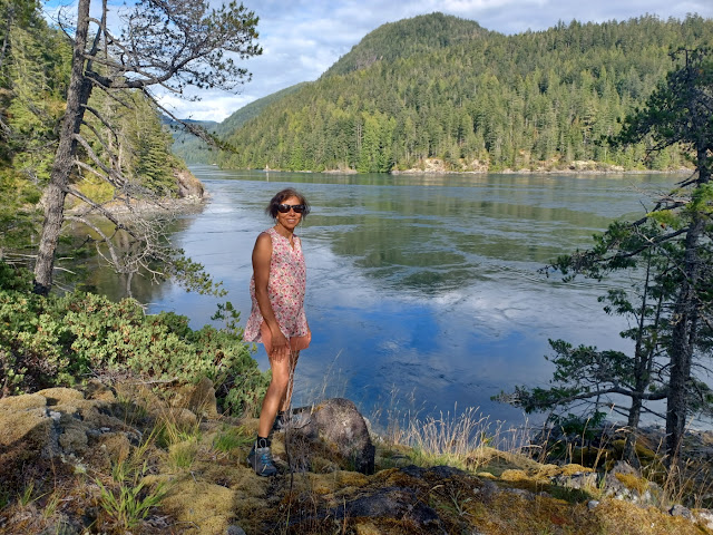 |
The overlook at Hole in the Wall
|
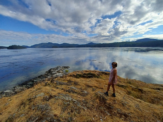 |
Looking out toward the Octopus Islands
|
 |
Tranquil Owen Bay
|
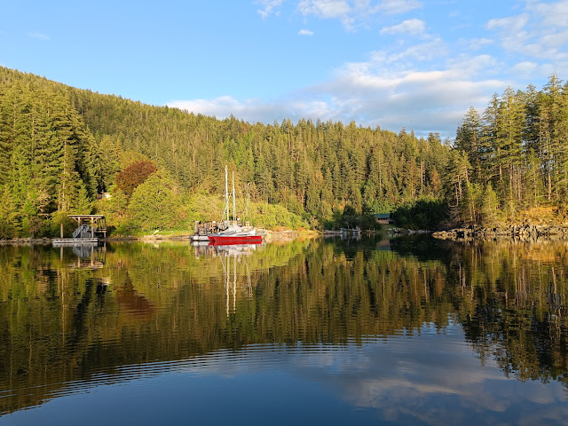 |
The dock at Owen Bay
|
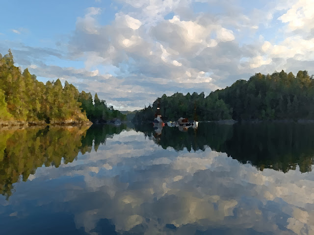 |
Morning at Owen Bay 'oil painting'
|
The
next day we made an attempt to reach a large lake that lies just a mile
inland from Owen Bay. There is no public trail, so we kayaked to some
mudflats beside a stream where there had clearly been a large first
nations village. The stream flowing from the lake was overgrown with
thorny bushes and the forested cliffs were littered with deadfalls. We
gave up after half an hour of sweaty bushwhacking. Apparently there is a
private trail behind the cottages at the head of the bay but no public
access to this trail.
Our next leg took us through the Lower Okissolo
rapids and around the coast of Sonora island to the Thurston Bay
provincial marine park. This is near the entrance to Johnstone Strait
and is as far north as we intended to go on this trip.
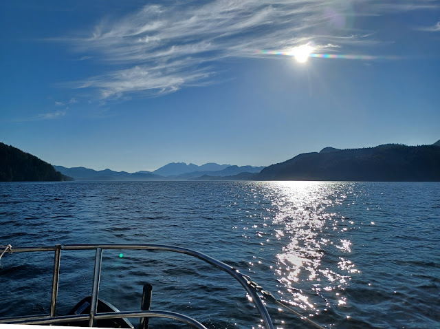 |
Motoring into Thurston Bay
|
Thurston Bay Marine Park has several anchoring choices including the attractively named Cameleon Harbour - named for a 19th centry surveying vessel, a lagoon, and Thurston Bay itself in the north. We anchored in the north portion near Block Island, thinking this would give access to a lake for swimming. Once again we were thwarted by dense foliage and hundreds of windfalls. The cruising guides mention a trail but if there was one, it has long disappeared into the rain forest.
 |
Quiet morning in Thurston Bay
|
 |
Peaceful Thurston Bay anchorage
|
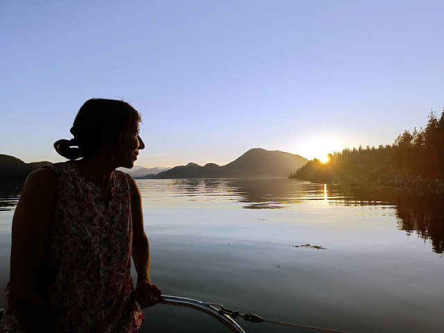 |
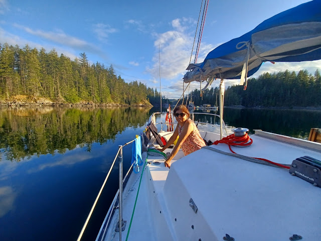
| Rani enjoys the sunset, grateful that the forecast strong NW winds did not visit us |
|
|
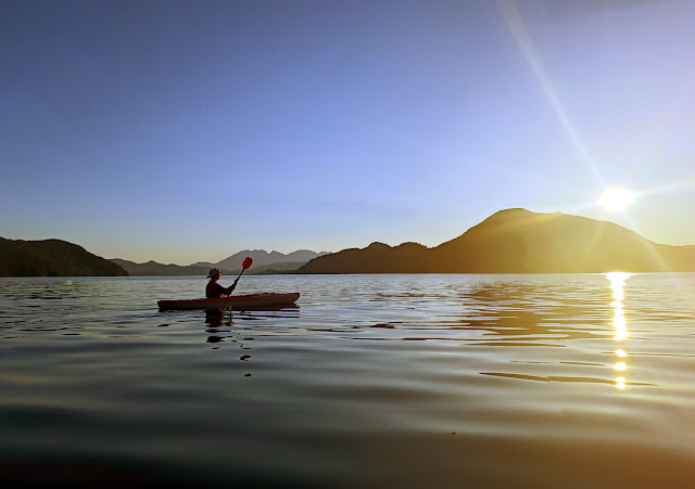 |
Late afternoon paddle
|
From Thurston Bay, we retraced our steps , returning to Quadra Island. I have not cruised much on the west side of Quadra, except to stop in Campbell River and Gowlland Harbour at the south end, so it was nice to see a new anchorage amongst the Chained Islands at the mouth of Kanish Bay. This area looked very promising for kayak exploration and we were not disappointed.
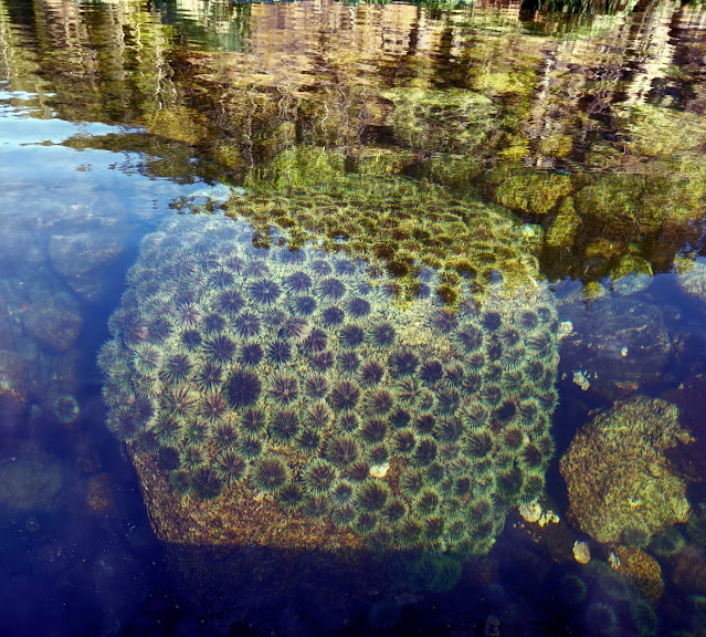 |
Sea urchins carpeted these rocks near our anchorage
|
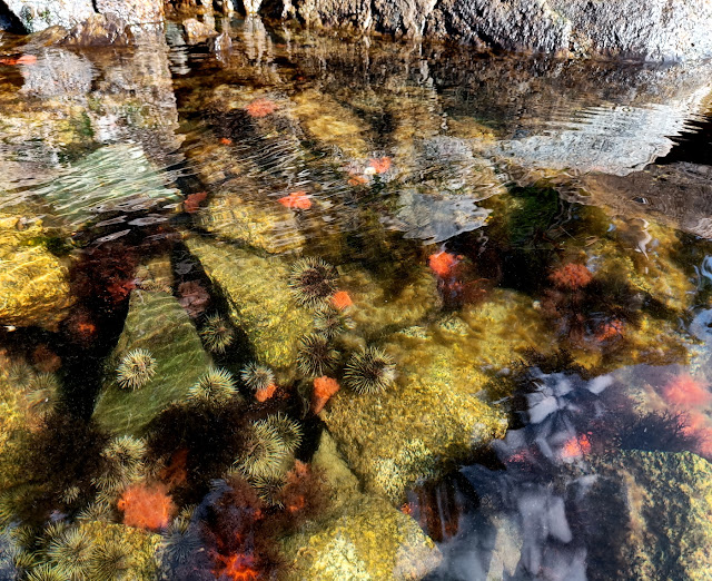 |
Urchins and anemones
|
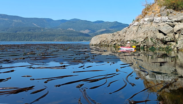 |
The Chained Islands have few coves or beaches so are best suited for day trips. Lots of kelp beds lie between and around the isalnds
|
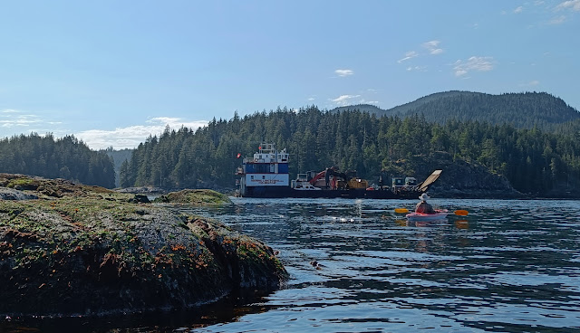 |
Marine Link transportation and adventure tours barge passes through a narrow pass in the Chained Islands
|
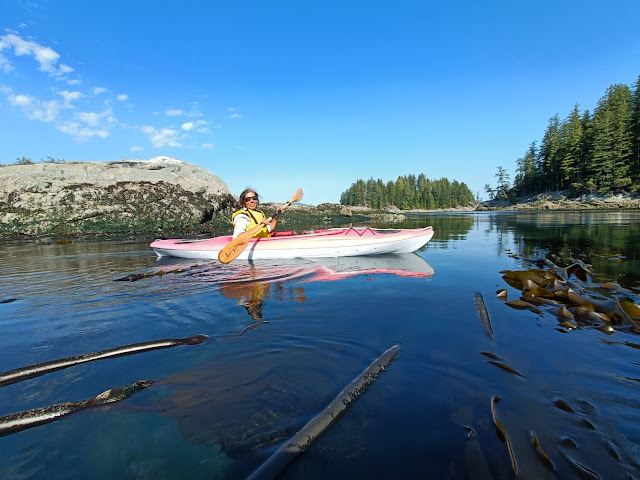 |
| Rani explores a kelp bed. There was a UVic research buoy nearby - not sure what they were studying here. |
|
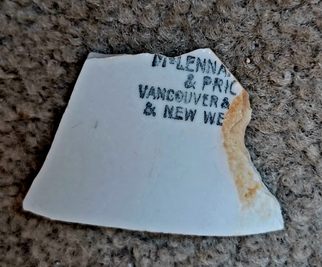 |
| Rani found this fragment of pottery that is likely a dinner plate on the beach off a large midden that must have been at least 8 feet thick and over 100 feet long |
|
After I posted this blog on Facebook, our friend Dave Rife shed some light on the piece of pottery found on the beach off the midden:
The
pic of a piece of junk on an old midden is probably part of a shipping
container from Maclennan, McFeely and Prior who were a Hardware and
Supply company located in Vancouver and Victoria in the early part of
the 1900's. They were commonly known as "Mac and Mac".
And a Google turned up this
article.
From the Chained Islands, it was less than two hours to sail to Small Inlet. This is mostly within protected park land and is a very scenic and quiet alternative to the Octopus Islands on the other side of Quadra. You can access the same hiking trails from there including a lovely walk up to Newton Lake. We hiked up to the lake after lunch and had a refreshing swim in its crystal clear waters. There were a few other groups of cruisers enjoying the lake but it was a delightfully quiet place anyway.
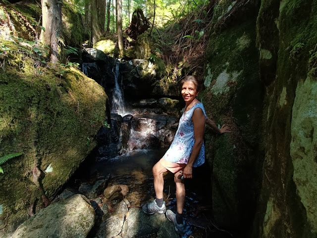 |
Nice cooling off place on the trail to Granite Bay
|
The next day we hiked over to Granite Bay and were able to get a cell signal. We had been without this for several days and it was a relief to check our messages and send emails and texts to my parents and Rani's friends and relatives. We also downloaded the current tables for Seymour Narrows before returning via the lake for another dip.
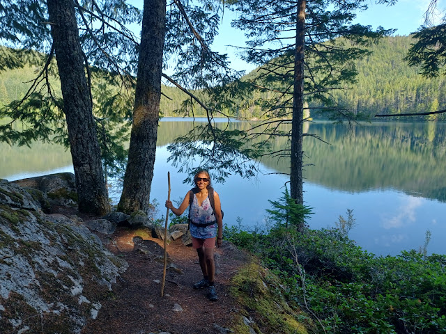 |
Newton Lake around suppertime. Rani is all clean and shiny after a lovely swim with only a couple of loons sharing the lake with us.
|
With some trepidation, we prepared to sail south through Seymour Narrows the next morning. This tidal rapid is even more dangerous than Hole in the Wall, if tackled at the wrong time. We needed to hit the narrows near slack but then wanted a flooding current to carry us further south down to April Point cove. This meant we had to leave earlier and fight an ebbing current for an hour or so. In Rani's words from her journal:
I was anxious about going through Seymour Narrows but we had the current data and Chris calculated the time to reach it for slack or close to slack. We stayed in the counter-current at the edge while the main flow was ebbing north and saved a lot of diesel. The narrows only had about 1/2 a knot of current against us at the north end and slack about midway. A couple of tugs were fighting the current trying to take a log boom down and another tug pulled a barge full of logs in mid-channel. We overtook the log boom quite quickly as it was a large one with logs piled up high, one tug pulling and a second one working very hard with great belches of diesel to keep the boom under control from the rear. It was a relief to get out of the narrows and to use the favourable current to continue to April Point.
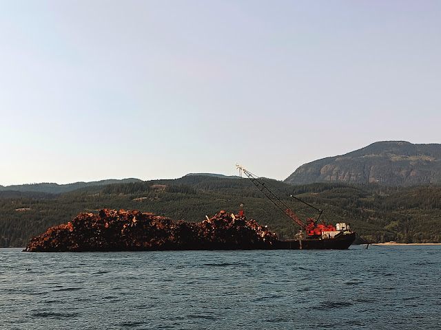 |
Log barge approaching Seymour Narrows
|
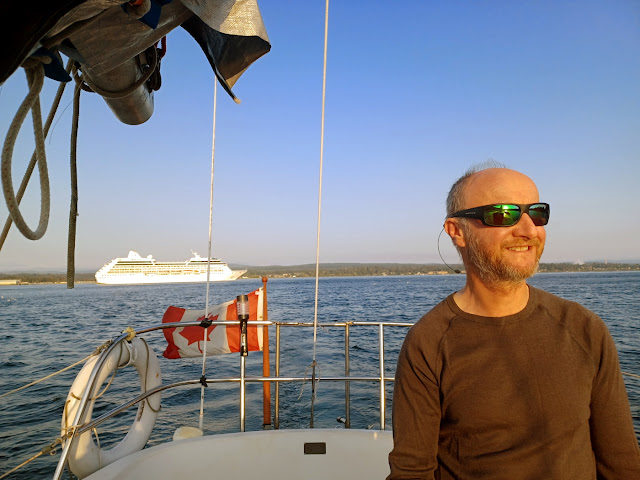 |
A cruise ship passes behind us as we head in towards April Point
|
We anchored between a small marina and April Point resort. We had been texting with our sailor friend Ernie since the morning and
it turned out he was anchored just one cove to the north. We had not seen him
since our Covid-era 2020 trip on Swamp Angel, so it was great to catch
up with him and swap stories in the cockpit.
 |
Our
sailing buddy from the 2008 trip to Mexico dropped by for a visit. He
is based in nearby Campbell River and was en route on his own boat up to the
Redondas
|
The nearest grocery store is in Quathiaski Cove to the south, so we knew we would have to walk a fair way into town to do our shopping the next day. We were pretty desperate for fresh food and ice by now, having been out for about 2 weeks. Like so many bays on this coast, April Point cove dries out into mud flats near its head, so getting ashore proved a bit difficult near low tide. We paddled the kayaks past the marina to a spot on the shore on the edge of the mud flats but I still lost my flip flops a couple of times while trying to carry the boats over the sucking mud and then over barnacle and oyster encrusted rocks. There was no obvious public access here, so we had to bushwhack through the woods and across a newly excavated driveway to get to the road.
Just as we emerged from the bushes with our shopping bags and a soft sided cooler, a car stopped and the driver asked us if we needed a lift into town. Neil and Helen McCubbin recognized us as boaters in need of help. It turned out that they were sailors who have crossed the Atlantic and Pacific in their 47 foot aluminum sailboat. They lived nearby and were running into town to do some errands. We quickly ran through our shopping list at the local grocery and our kind hosts drove us back to our kayaks and invited us to join them on a hike the next day.
Neil and Helen live right on Unkak cove at the north end of Quathiaski Cove. They told us that there was a pretty good anchorage south of Unkak cove, so the next morning we motored over and anchored off Grouse Island within sight of their house. The anchorage is fairly well protected but you do get currents swirling around you, which can put you closer than you expect to other boats anchored nearby. It reminded me a bit of what happens in La Paz Mexico in the Mogote anchorage where the cruisers refer to this as the La Paz waltz! We kayaked ashore and drove with Neil to a trailhead to join member of the Quadra Island Outdoor Club to hike the Thompson trail. Later, we had supper with Neil and Helen and enjoyed the fantastic views from their lovely home, which sits out on a point.
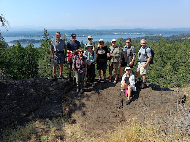 |
Members of the Quadra Island Outdoor Club who kindly allowed us to join them on a hike to this viewpoint that looks out toward Campbell River. Our host, Neil is on the top left
|
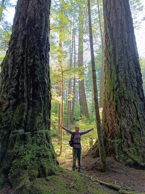 |
There are some impressive trees on Quadra Island
|
We had some appointments scheduled for the next week, so we decided to make tracks south. We sailed one long day that took us almost as far as Pender Harbour on the Sunshine coast. We anchored a few miles north in a Quarry Bay. The anchorage here is iffy, with several rocks charted in the wrong place on our e-charts, but fortunately these were marked by locals. Lots of newly built cottages line the shores here.
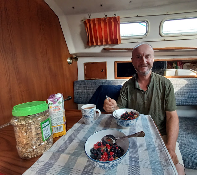 |
Breakfast with fresh salal and huckleberries added to our daily granola/muesli mix
|
We crossed the Strait of Georgia the next day, avoiding the torpedo testing area of Whiskey Golf, which was active that day. This required us to make a large zig zag towards Nanoose and then run parallel to the coast inside the firing range area. We heard a few boats being called on the VHF and asked to avoid the firing area. Two did not reply and a helicopter had to be dispatched to warn them off. Part of a transmission from the military controller on Winchelsea island went like this: "Sir, if you were to be hit by a torpedo, your boat insurance would not cover you because you are in a defined military exercise area."
Thinking to avoid the crowds off Newcastle Island in Nanaimo we anchored at the north of the island near a buoyed ship wreck. This proved to be a thoroughly stupid idea because the bottom was foul with numerous cables and metal objects from what must have once been the site of a quarry and dock. I had to dive the next morning to free up anchor chain that was wrapped around a large metal object as well as to remove a length of yellow polyprop rope from the anchor itself. Fortunately the water was 70 degrees and only 25 feet deep. We stopped the next day at the cottage and had enough time to to catch up with friends at the Sunday coffee morning before motoring home to Maple Bay.
In all we were out for three full weeks. Getting back into the home routine has been a bit difficult as one gets quite used to a having a new adventure each day...


