Rani has always been a hiker. It defines her perhaps more than anything else. For a few years now she has been thinking of hiking to the Golden Hinde, the tallest mountain on Vancouver Island. This year, things finally came together with our friends Jen and Jim wanting to do the trip too. All told there were 6 of us in the party by the time our planned departure date of August 6 rolled around. Simon is a hiker from Saltspring Island who hikes occasionally with our Cowichan group and Larry, another Cowichan hiker, who has hiked in the mountains around the Hinde also joined us. Simon, Jim, and Jen's pictures illustrate this blog entry because we managed to leave our camera's memory card behind in Duncan.
The Golden Hinde, named for Sir Francis Drake's flagship lies in the center of the island surrounded by the
mountains of Strathcona provincial park. At 2,195 meters it is no Everest, but getting to the base of this mountain is a strenuous multi-day hike and getting to the top requires Class 3 and 4 scrambling on some fairly exposed stretches.
 |
| South east gullies route and approaches to the summit of the Golden Hinde. Photo from Phillips Ridge |
We prepared for the trip by doing a few hikes with loaded packs. Rani ended up carrying 15 kgs and my pack was nearer 20 when we left with camping gear and food for 8 days + 2 liters each of water. I visited my brother in Vancouver where we augmented our gear from his extensive collection of therma-rests, camp stoves, sleeping bags, and climbing gear.
 |
| Ralph River flows into Buttle Lake |
On Saturday, we drove to Ralph River campground in Strathcona park and car camped there with the rest of the group so we could start up the trail first thing Sunday morning. The trailhead is half an hour from the campground, beside the Westmin copper mine, which provided a noisy backdrop for the first couple of hours of hiking. You begin up a series of about 150 long switchbacks which rise 900 meters to Arnica Lake. This section of the trail is well built although in a couple of places recently fallen old growth tree trunks lay across the trail, requiring detours.
 |
| Rest at Arnica Lake - Jim (our leader), Jen, Larry, Rani, and Chris |
Beyond Arnica Lake, the trail climbs steadily up through the woods onto Phillips Ridge along a well worn route. Rain was in the forecast for Sunday through Tuesday and sure enough the first drops fell a few minutes past the lake. We had intended to make camp at a tarn just before the first major bluff on the ridge, but instead sought shelter from the rain half an hour before the tarn, making a short day of it.
 |
| First day we had the chance to try out our rain gear |
 |
| Drying out at our first day's campsite. |
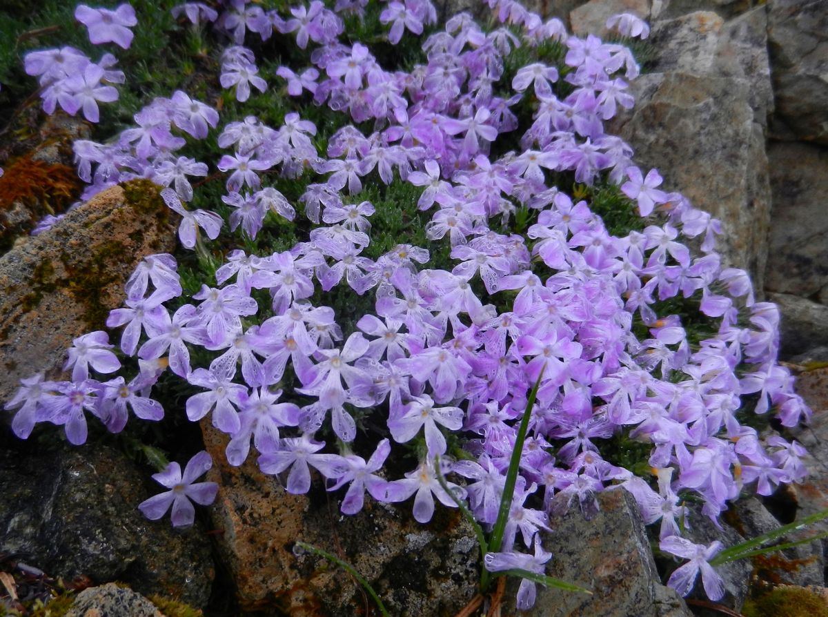
The next day the ridge was bathed in low cloud although we had occasional glimpses of mountains and ice fields. We hiked along Phillips ridge, pausing at the tarn where we had intended to camp and then climbing up out of the trees onto a higher section of the ridge. The recent rains had brought on wild flowers including brilliant yellow arnica, phlox, Indian paintbrush, penstemon, and monkey flowers.
 |
| Mist and low cloud were our companions the first 3 days |
The trail became less distinct as we left the trees and we had to rely more on cairns, which were sometimes hard to pick out. We took turns leading and did not push things too hard as we only intended to cover about 10 kms that day.
 |
| Rani hikes beside a snow field. We saw the first snow just above our first camp. |
 |
| Impressive snow fields |
Near supper time we reached a gully full of massive boulders where we would descend to Carter Lake should we take this approach to the Hinde. Because we had decided to try another route further along the ridge, we climbed up the steep gully side and made camp at the first plateau beyond the gully. Once again, the rain began in the afternoon and our campsite was a damp one. A brisk wind blew a mist continuously through the camp and when you sought shelter from this behind the trees, clouds of mosquitoes did the same.
 |
| Second camp - we would return to this for the third night, too. |
 |
| Hiking along Phillips Ridge |
 |
| The Golden Hinde from Phillips Ridge |
The third day dawned bright with low cloud hanging in the valleys on either side of the ridge. Had the visibility been poor we would have descended to Carter Lake, but instead we decided to push on and try to follow a route described by one of our hiking friends that he had used 14 years earlier on his approach to the Golden Hinde. We hiked along the ridge. passing over an area of limestone where we could hear water running beneath us and then left the trail descending a scree field above a series of dark bluffs over the southeast end of Schjelderup Lake. The scree was steep and the rain which had returned, slowed down our descent.
 |
| The wildflowers were particularly vivid in the swirling mountain mists, |
 |
| Steep scramble down the scree field. |
At the base of the scree field we traversed to a gully over the top of another scree field that descended steeply to the lake. We fixed a rope across the gully and transferred people and packs to a shelf on the far side and then repeated this procedure to get everyone safely down to ledge above a steep drop.
 |
| Using climbing rope on the crumbly slope. |
By now, some of our group were expressing concern about the danger of this route and the fact that it was not clear if there was a good way out of this gully onto a shelf that we believed would take us down gradually to the north end of Schjelderup Lake. Our leader Jim decided to scout ahead and climbed down the next part of the chute. As he returned, we heard a rumbling from above and rocks began to fall and bounce down the main chute. Everyone screamed a warning to Jim and for a few seconds we thought he had been caught in the slide, but then his head popped up from behind an overhang to the side of the main chute where he had sheltered, unscathed. The message was heeded. We quickly decided to retrace our steps to day two's camp.
 |
| Retreating from the gully where a rock fall came near to reducing our numbers by one. |
On day 4 we returned to the boulder filled gully that leads to a steep wooded descent to a stream below Carter Lake. On the way down we met a couple of lads who had left the same day we had. They were making an all day trek from their camp near the Golden Hinde to the car because they were running low on food. They had climbed partway up the Hinde the day before but were unsure if they had reached the summit (I believe they tried to climb up the west ridge, which gets pretty steep about half way up). We paused at the stream crossing to take pictures of the waterfalls that cascade from Carter Lake before climbing up to the lake.
 |
| Rani and Chris stand in the stream below Carter Lake |
 |
| Rest stop at south end of Carter Lake with scree fields on left |
 |
| South end of Schjelderup Lake |
The traverses along the shores of Carter and Schjelderup Lakes were slow going with several detours away from the shore to climb up through the woods around bluffs that drop off into the lakes. The boulder fields of Schjelderup were to prove Rani's undoing. She lost her balance when her pack slipped to one side, falling back heavily onto a sharp edged granite boulder, striking her head and breaking her glasses. Fortunately she managed to break some of her fall with her arm and we were able to patch up her cut temple and scraped jaw and arm from our ample first aid kits. I carried her pack through the rest of the boulders while she recovered from the fall and we proceeded to the camp at the end of Schjelderup lake to rest up.
 |
| It is hard to see the person in the lower right third of this picture. This shows how big the boulders are on the shores of Schjelderup Lake. |
 |
| Monkey flowers by a stream at the north end of Schjelderup Lake |
 |
| Looking south from the north end of Schjelderup Lake, The scree field is below where we got stuck after climbing down from Phillips Ridge in our failed attempt the day before. The thin scree slope above this is shown in one of the pictures above ("Steep scramble down the scree field") |
With the advantage of hindsight and time to study Phillips Ridge from the lake shore, we were eventually able to piece together where we had gone wrong the day before. We should have continued over the next hill on the ridge and come down in the next col, staying higher on the ridge and descending to the north end of the lake.
 |
| Plaque at north end of Schjelderup Lake |
The next leg of the trip was one that we all enjoyed - a short but steep climb above Schjelderup Lake lead to a gently ascending traverse to Burman Ridge. We refilled our water bottles at a stream that poured out of the snow fields under the bluffs below Mount Burman and pushed on to Burman Ridge which points like a finger at the Golden Hinde. The ridge walk provided stunning views over dozens of snow capped peaks to the west with Burman Lake in front of us and Phillips Ridge to the east. An hour later we were descending the last of the cliffs before setting up camp at the end of the ridge.
 |
| Hiking up to Burman Ridge |
 |
| Simon poses for a picture on Burman Ridge with Burman Lake below |
 |
| The group - Jim, Jen, Rani (note bandages), Chris, Larry, and Simon - The western side of the Golden Hind is to the right. |
 |
| Campsite below near the north end of Burman Ridge below the Golden Hinde. |
Day 5 - Thursday - was the ascent day. Larry left around 6 am to get a head start and the rest of us headed out shortly after 7 am. The weather was perfect and we looked forward to some great views from the top. The route climbed steeply down from our campsite plateau into a gully at roughly the level of Burman Lake and then ascended though a series of plateaus toward Climbers Lake at the base of the Golden Hinde.
 |
| Early morning light on the Golden Hinde from Burman Ridge camp |
 |
| Simon heading off for the Golden Hinde |
 |
| Jim and Jen on a plateau approaching Climber's Lake - Burman Lake lies below. |
One surprise (to me anyway) on this trip had been the quantity of bugs - mainly mosquitoes and no-see-ums - that had been with us in every camp and on most of the trail. Today was no different and the mosquitoes were particularly thick around the lake and would follow us all day. We refilled our water bottles and crossed a low snow field that lay like a vast white tongue hanging down to the edge of the lake.Our route followed the edge of the scree field, switch-backing gently along the right side of the bowl, staying as much as possible on solid rock and greenery. We were heading for a higher snow field that marked a gully - the only simple approach to the higher south east gullies that run up above the broad SE shoulder.
 |
| Rani, Simon, and Chris survey the route. |
 |
| Heading up the first snow field above Climbers Lake |
 |
| We stayed at the edge of the scree field, on stable rock and earth. |
 |
| Simon switch-backing above Climber's Lake |
We located the gully and scrambled up it onto the shoulder, immediately working our way higher, following a fairly clear tread up to the top of another scree field. We had some difficulty deciding which gully to choose for the last portion of the ascent, but Jim recognized it from a huge boulder that he remembered from studying the approach on Google Earth. Jim had 'flown' over the entire route using this tool and had brought colour photos with way points overlaid to help us stay on track.
 |
| Lower gully above first scree fields, leading onto shoulder. |
 |
| Once on the shoulder, we climbed fairly rapidly, staying mostly to the left of the large scree field here. |
 |
| Simon and Rani scrambling up toward the SE Gullies |
The SE gullies contained the most difficult scrambling of the climb with a couple of exposed sections. However most of the route was fairly easy (on the way up), the main issue being loose rock. Helmets are a very good idea on this section and we also stayed very close to each other so that any loose rock would not have far to go before it passed the last member. While we could have bypassed the steeper sections by climbing up the adjacent snow field, none of us had the necessary gear or training for this.
 |
There is not always snow in the gullies, but when we were there, this tongue descended from near the summit.
|
 |
Rani looks at one of the more exposed sections of the SE approach gully
|
 |
| Jen, Jim, and Rani lead the way over scrambly rock with Larry and Chris following. |
At the nose just below the summit, we met up with the family - mother, father, and 13 year old son - with whom we had shared last night's camp. They had taken a similar route to ours but had overshot the easiest gully approach and climbed up some steeper chimneys, one gully over. Fortunately the parents were both rock climbers and had brought rope to help their son across the trickier sections.
 |
| Rani chats with the family we met on the nose. |
A minute more of scrambling across boulders and we were on the summit. It was around 1 o'clock and the weather had held fair so we had near perfect visibility.
 |
| Simon elated to be on the top of Vancouver Island |
 |
| Larry holds up a well-travelled flag loaned to us by our friend and mentor, Del while Rani updates the summit register. |
 |
| The summit is a pile of loose rock with 360 degree views of Strathcona park. We could see the ocean on both sides of Vancouver Island from here. |
 |
| Rani and Chris on the summit. |
Larry sent a text message via satellite, although it turns out there is cell phone coverage on top of the mountain (though nowhere else on the trail).
 |
| View south showing our route in (not showing our 3rd day's side trip) |
The climb down was slow. It is always harder to move back down a slope, braking carefully so as not to dislodge rocks on your companions and stepping backwards down the steeper sections. We waited for three quarters of an hour in one place so as not to risk sending rocks down on the family in front of us who were using a rope belay to help their son over the harder sections. Then we did the same thing using body belays in two sections, more for assurance than out of necessity.
 |
| We take a break to enjoy the view |
 |
| We slid down the snow field on the return trip to Climbers Lake |
When we reached the bowl below the main scree slopes, we skied or slid on our bums down the last snow field - very happy to be past the steepest sections. Simon, Rani, and I stopped to bathe in the chilly waters of snow-fed Climber's Lake before descending to the level of Burman Lake and back up the steep slope to our plateau camp. The last of our group made it in near 8:30 PM after more than 13 hours on the go, very tired, but elated that we had all made it up and back.
 |
| Rani enjoys a brief and very refreshing dip in Climbers Lake |
It only took us 2 days to hike back out, retracing our route along Burman Ridge, down along the lakes and back up onto Phillips Ridge. We camped the last night just above the boulder filled gully where we joined the ridge after climbing up from Carter Lake.
The final day was a slog. We covered in one day what had taken two on the way in, but this time with gravity in our favour. Still, as has been often noted, the switch backs down from Arnica Lake do go on forever! We drove into Campbell River to a Greek/Pizza restaurant and wolfed down huge plates of excellent food before the long drive back to Cowichan Valley.
We look forward to returning to Strathcona. It is an immense and beautiful park and this trip just gave us a glimpse of what it has to offer.