Thursday, August 20, 2020

New Zealand 2020 - part 1


We finally returned to New Zealand at the end of January this year - a trip we had intended to make a couple of years ago. We had promised our friends Roz and Holger to visit them and take home items we had left with them when we sold our sailboat in New Zealand in 2014. We also planned to do some camping and to visit other friends on the North Island.

The Covid-19 pandemic was just beginning  and was mostly confined to China but we brought masks with us and wore them in the airport when a plane from Shanghai joined us in the customs line.  We rented a cheap car (15 Canadian dollars a day!) near the Auckland airport and drove to our friend's farm near Whangarei. Over six weeks we were to spend about two weeks at their farm, two on their sailing boat 'Melody', and the remainder visiting with another NZ  sailing friend, Jo Woollacott and hiking and camping in the Northland.

We came across this bird en route to Whangarei from Auckland

One of our first activities was to extract honey from Roz and Holger's bee hives. Rani is suited up to help with the smoker and to brush bees from the frames.


Rani pumps smoke to calm the bees while Holger removes the frames from the first hive.

Inside their newly built 'shed' Rani removes comb from the frame.

Holger squeezes honey through (unused) pantyhose. For small amounts this apparently works better than using a spinner. It is hard work as we found out when we both tried our hands at this.


A somewhat disturbing birthday party for Holger

Our sailing friends from Picara (now sailing and living on Fairsky) - Mike and Marni - dropped by for a visit and a game of pickup sticks using offcuts from the garden


Tension builds and advice flows freely

Roz proved to be a talented 'pick up sticker'


Rani enjoys a lively sail on Melody

Holger at the helm with Roz navigating

Historical plaque/sculpture in Bay of Islands


We saw this kiwi on an island in the Bay of Islands

The kiwi was quite unperturbed by our presence.

We sailed north to Whangaroa Harbour and climbed the 'Duke's Nose'. I had been here a few times but this was Rani's first vist.

Panorama from the Duke's Nose

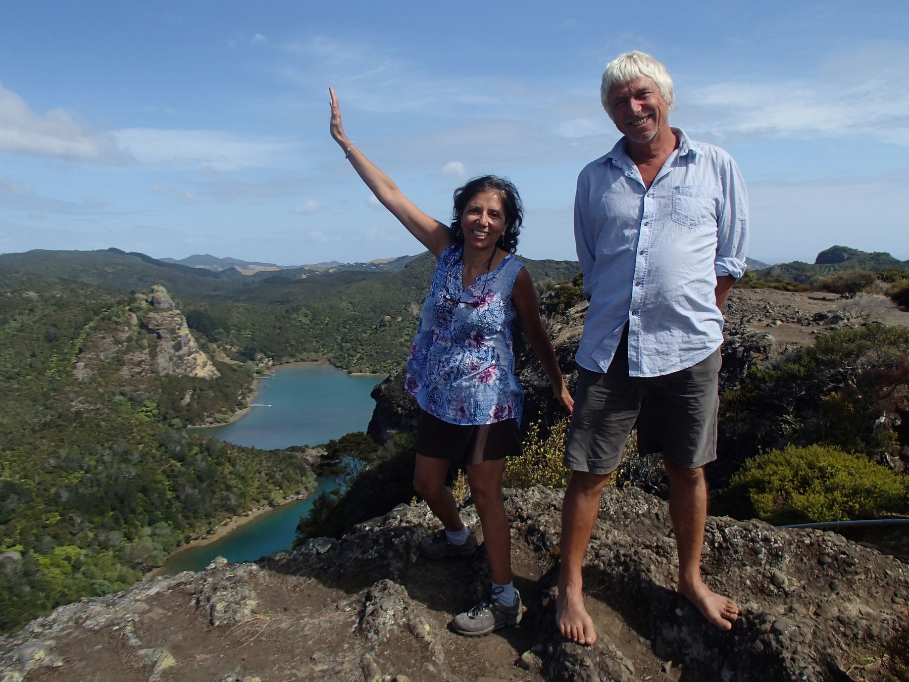
Holger hikes everywhere in bare feet

On the trail to the light house at Cape Brett


Rani and Holger enjoy the view near the lighthouse


Such grace...

Back on board melody for a well deserved home-made beer

This crazy rock 'head' with it's own hairdo is on a coastal ridge trail that runs from near Urquharts Bay to Ocean Beach.


   I will save the pictures from our car trip up to the north tip of New Zealand for Part 2 

Sunday, July 19, 2020

Return to Princess Louisa Inlet

My friend, Ian Costanzo and I have spent several weeks, over the years, cruising together on sailboats. This year we decided to spend a 9 day 'week' visiting Princess Louisa Inlet. We planned to sail up the inlet and attempt to locate and hike the path up to a plateau above the inlet that I had read about in the 'Curve of Time'. Thanks to Ian for joining me on this trip and for providing some of the photos below.

Motoring up Jervis Inlet

We sailed from Maple Bay on 'Swamp Angel' our 1968 Nicholson 32, reaching Nanaimo the first day. Here, we warmed up for our potential hike by walking a circuit of Newcastle island. The next day we pushed all the way across the Strait of Georgia, beating into 15 to 20 knot headwinds and then motoring into Jervis inlet to the Harmony Islands. Day 3 was a motor to the head of Princess Louisa inlet 40 miles away, stopping en route for some kayaking at Soda Falls. At Princess Louisa Inlet, we anchored just to the left of the falls with a stern tie to an enormous boulder.

Ian kayaking at Soda Falls in Jervis Inlet - we took turns playing in the surfy water, letting Swamp Angel drift off the falls.

Swamp Angel at anchor in Princess Louisa Inlet next to Chatterbox falls.
Kayaking at Chatterbox falls - photo by Ian

On day 4 we climbed up to the Trapper's cabin where Rani and I had hiked a few years ago. On that occasion we were literally soaked to the skin and waterlogged by the time we descended. This time, we were grateful to have sunny weather. We made sure to leave very early because we hoped to reach the 6000 foot summit plateau and return in one day. From the trapper's cabin we crossed the stream, taking off our boots and traversed a short way south until we reached another stream. Here we got off trail for about 40 minutes, following, by mistake fall line flagging tape. We retraced our steps and found a roped route up a rock face where someone had pulled the rope up and tied it to a tree at the top. I climbed up and dropped the rope and we donned our packs and ascended beside the rock face.

Rooty climb - photo by Ian

Letting down the rope to assist in the climb - photo by Ian

From the top of the rock the trail crossed another 2 creeks ascending fairly steeply to another rock face where again we lost the trail for a few minutes. Turning left at the rock face, we dropped down to a 4th creek at somewhere around 3000 feet elevation, where we climbed through a cave (using a provided rope) and on up the creek bed to a further wooded ascent. The mosquitos got gradually worse as we ascended and we stopped to Deet up.

Ian looks back at the falls by the Trapper's cabin


View from about 3000 feet where we came out into the 4th creek bed. Princess Louisa inlet is just visible from here but hidden behind Ian's back

At the top of this ascent we found the north traverse we had read about in one of the blogs. Here was a nice level walk through woods and by tarns where we encountered the only really muddy section of the trail.

Walking along the north traverse - photo by Ian

The trail climbed a bit further until we reached a ridge with fantastic views to the north and west. We entered a snow filled gully, which in a week or two would probably have been clear of snow. Near the end of the gully, a clear path dropped down to the north to a campsite and our lunch spot at somewhere around 4000 feet elevation. This overlooked a couple of small lakes that were still choked with snow and ice. 

Climbing up the snow filled gully - the trail is under the snow here.
Photo from the lunch spot showing the base of the climb to the plateau we reached after lunch and the actual summit plateau to the upper left.
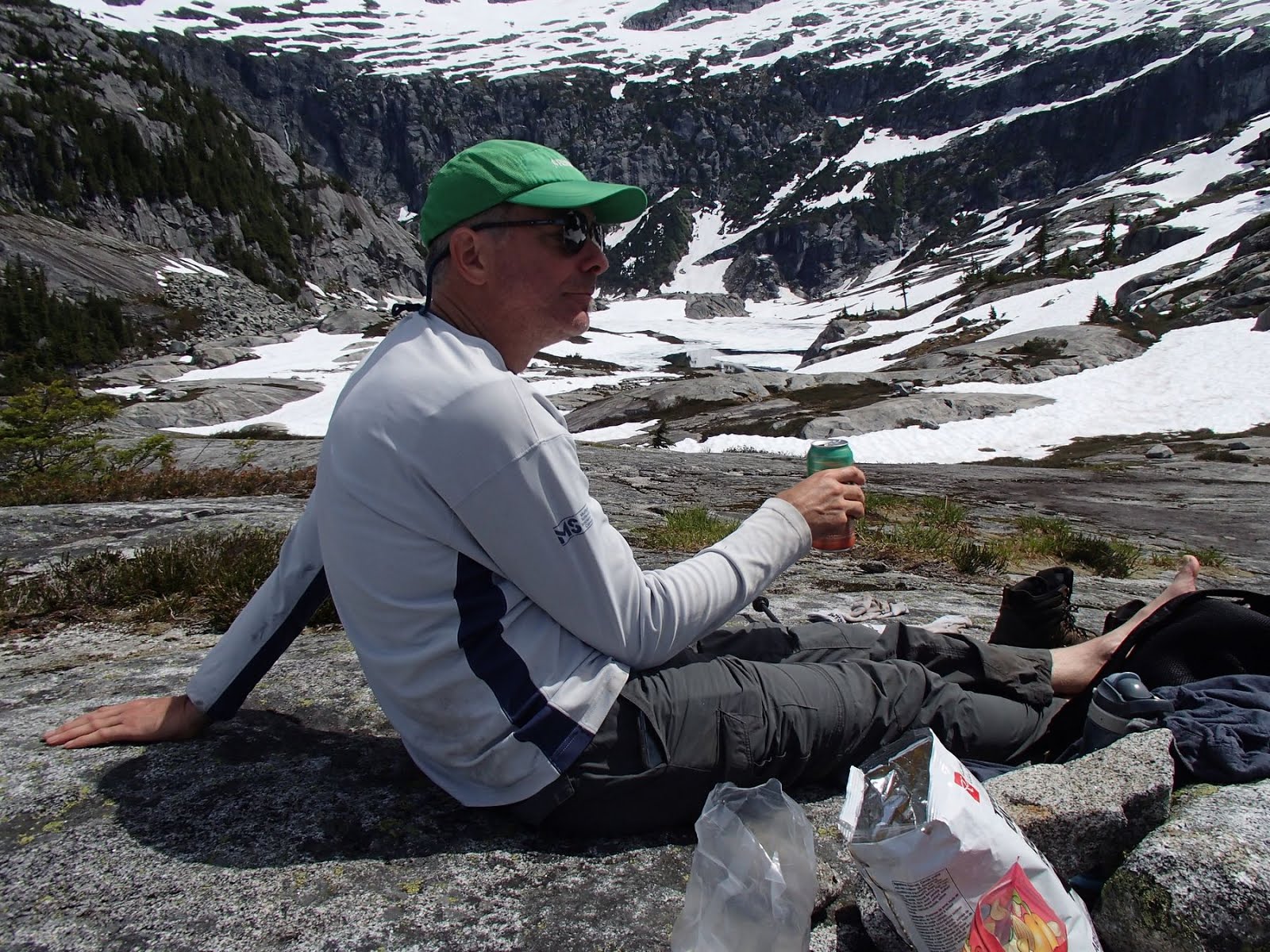
Enjoying a much deserved beer


Panorama above lakes near lunch spot


After a break for a much deserved beer and hummus and veggies we climbed back up and continued off trail up the gully and onto a series of rocky slabs and snow filled depressions. We reached about 5000 feet where we came out onto a plateau facing back down Princess Louisa inlet. I left Ian to enjoy the view and nurse a sore knee and climbed up to a local height for a panoramic view at about 5300 feet. We would not have time or energy to reach the final summit plateau above, which would have required slogging over snow filled dips and across rocky slabs.

Climbing up to the plateau


On the plateau - photo by Ian


View back to Princess Louisa Inlet. Our boat is the small white dot at the lowest point of water.

Panorama from the highest point reached


Panorama from the lower plateau - photo by Ian


We returned to the trail by retracing our steps and came across a party of 4 younger people off a small sailboat who intended to camp out above the lakes. They were surprised we were making a day trip of it, but I think that they likely had a harder time of it than we did with their heavier packs, even spread over 2 days.

Steep but manageable with the provided rope

Most of the trail is in the woods - this section was beside some lovely massive mossy rock bluffs

The descent was steep but manageable and we reached the boat in time for a late swim in the chilly ice cooled waters below the falls.

I guess we should have read the sign before we went up! - photo by Ian

GPS track of the route - the red mark is roughly where the first rope climb is found, top right is our lunch spot near the lakes and far right is the highest point reached.

After we returned to our boat, the Azura anchored beside us. It is 40 meters long and was made in Australia. It had no port written on it, so I am not sure if it is Canadian or a covert international boat here despite the Covid-19 restrictions. 

The return trip out of Jervis inlet was a pleasant motor with a few hours of sailing and we made it to Pender Harbour in time to avoid the south east winds that had been forecast for the next day. We rested there one day, exploring the harbour's many bays by kayak. Two days later, broken up by brief overnight stops on Jedediah and De Courcy Islands, we were back in Maple Bay.   

We anchored near a ship wreck storage area in Pender Harbour called Whiskey Slough - photo by Ian

Leaving Pender Harbour we were reminded of what can happen so easily if you let your guard down or are just unlucky - photo by Ian

A nice flat walk on Jedediah island on the way home. The island is a park with several lovely trails through woods and old pasture.

Thursday, January 2, 2020

Desolation Sound in a Nicholson 32

In late November I purchased Swamp Angel, a Nicholson 32 sailboat, built in England more than 50 years ago. She is a full keel blue water boat that has seen a few adventures including a transit of the Panama Canal, sailing the Atlantic seaboard, and a trip to Mexico and back. By coincidence we had met the previous owners, Greg and Lorraine, in early 2009 when we arrived in Mazatlan Mexico on our first Ladybug.

Nicholson 32 Plans
Swamp Angel as we bought her

Rani returned from the UK in December after nearly a year away from home and after a bit of arm twisting agreed to accompany me to Powell River where Swamp Angel is currently moored. (We will keep the new boat in Powell River until we can sell our other boat, Drifter) 

We brought along plenty of food, sleeping bags, and lots of reading material and headed north to Desolation Sound the day after we arrived. The winds were light and following for much of the trip north so we ran under diesel until we entered the sound where we had a light NW wind that allowed us to sail for an hour or two. The Unwin range at the head of the sound was wreathed in cloud but we were happy to catch glimpses of peaks as we sailed in.

Rani on the foredeck heading into Desolation Sound


Unwin Range

We had a weather forecast that promised reasonable weather for a day or so followed by a day of rain and near galeforce winds followed by calm weather. So we decided to find a well protected anchorage on day one and stay there for three nights. We selected Melanie Cove in Prideaux Haven because it is extremely protected and also offers some nice hiking. We were happy with our choice and saw almost no wind in the anchorage despite high winds in the Strait of Georgia outside. We saw no other boats for the three days we were there nor were there any visible from the places we hiked to.

Peaceful Melanie Cove
Lots of water in the creek at Laura Cove

On our second day we hiked the trail out to Melanie Point as well as the one to Laura Cove and beyond up another lightly used trail where we came across the remains of a squatter's camp. The trails were a bit wet and there were a lot of wind fallen logs, which have not been cleared probably because the trail is unofficial and not maintained by the parks people.

Interior of Swamp Angel showing the diesel heater - a great comfort on this trip.
View of the Unwin range from the end of our walk past Laura Cove


Melanie cove was also packed with jellyfish. I remember this was true also on the one other occasion I have been here (in May 2005) but this time there were much larger ones as well as the 2 to 4 inchers I remembered.

Moon Jellyfish - Aurelia Aurita - Not easy to photograph, but the video gives a better idea


The trip home was also done mostly under motor and we were treated to mountain views as well as sightings of a humpback mother and calf. The whales swam so close to the boat that their breathe spray settled on our faces. We were too busy enjoying the experience to take any photos!

Swamp Angel under sail. Note the wind generator and vintage solar panels.